
Quebec City’s surrounding wilderness offers eight standout trails that range from family-friendly riverside walks to grueling summit climbs with 800-metre elevation gains. Whether you’re chasing panoramic glacial valley views or testing your endurance on technical ascents, the trails within an hour of the city deliver distinct challenges and rewards that make choosing the right route essential before you lace up your boots.
The best hikes near Quebec City span three difficulty tiers. Beginner routes like the 6 km Cap-à-l’Orignal loop provide coastal scenery accessible at low tide, while intermediate trails such as the Loups trail in Parc national de la Jacques-Cartier showcase spectacular glacial valleys across the park’s 100+ km network. Advanced hikers gravitate toward L’Acropole-des-Draveurs, an 11.2 km round-trip climb in Parc national des Hautes-Gorges-de-la-Rivière-Malbaie that rewards the 800-metre ascent with valley views that genuinely earn the “speechless” descriptor.
When you plan a hiking trip around Quebec City, matching trail difficulty to your fitness level matters more than chasing the most Instagram-worthy summit. A moderately fit hiker can tackle most intermediate trails with proper footwear and hydration, but the advanced routes demand trekking poles, layered clothing for rapid elevation changes, and honest assessment of your stamina. This guide ranks each trail by challenge level and highlights the specific features that make it worth the drive, so you can pick routes that align with your skill set and the views you’re after.
How We Selected These Trails
We evaluated every trail on this list using consistent, measurable standards that reflect what actually matters when you’re lacing up your boots. Our goal wasn’t just to catalog nearby paths, but to identify which ones deliver the best experiences for specific hiking goals and skill levels.
Here’s what we assessed for each trail:
- Difficulty markers: total distance, elevation gain in metres, and terrain type to match routes with appropriate fitness levels
- View quality: presence of valley panoramas, coastal scenery, waterfalls, or ridge-top vistas verified through park documentation
- Accessibility factors: seasonal restrictions, tide requirements, trailhead access, and route marking standards
- Distance from Quebec City: trails within a reasonable drive to maximize hiking time over travel time
- Trail network diversity: variety that serves everyone from first-time hikers to experienced summit-baggers
We relied on verified data from park authorities and established trail systems rather than user-generated reviews, ensuring you get accurate distances, elevation figures, and current access restrictions. Every trail featured here has documented characteristics we could confirm, from the 800-metre climb at L’Acropole-des-Draveurs to the tide-dependent timing at Cap-à-l’Orignal.
1. L’Acropole-des-Draveurs, Best for Experienced Hikers Seeking Epic Valley Views
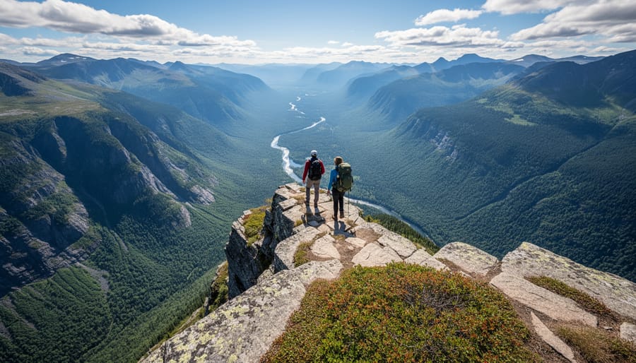
L’Acropole-des-Draveurs stands out as the most demanding trail on this list, rewarding skilled hikers with one of the region’s most dramatic payoffs. Located in Parc national des Hautes-Gorges-de-la-Rivière-Malbaie, this 11.2 km round trip pushes through 800 metres of elevation gain, a serious vertical challenge that separates casual walkers from committed climbers.
The ascent is relentless. Expect sustained uphill sections through mixed forest terrain, with rocky scrambles becoming more frequent as you approach the summit. Your legs will feel every metre of that elevation gain, particularly in the final third where the grade steepens noticeably. This isn’t a trail for testing new boots or shaking off winter rust.
At the top, the valley view delivers exactly what that grueling climb promises. The panorama spreads below you in a way that genuinely leaves you speechless, showcasing the deep river gorge and surrounding peaks in their full scale. It’s the kind of vista that makes you forget your burning quads for a moment.
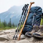
Gear matters here. Bring trekking poles for the descent, your knees will thank you after dropping 800 metres. Pack layers you can shed as you heat up climbing, plus a wind shell for the exposed summit. Carry more water than you think you need; there’s no reliable source on the trail. Sturdy boots with ankle support and aggressive tread are non-negotiable on the rocky sections.
Plan four to six hours for the full round trip, depending on your fitness level and how long you linger at the viewpoint.
2. The Loups Trail, Best Glacial Valley Panorama in Jacques-Cartier
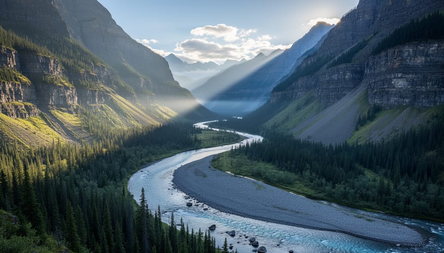
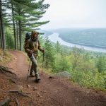
The Loups trail stands out as one of Parc national de la Jacques-Cartier’s premier hiking experiences, delivering what many consider the park’s most dramatic glacial valley panorama. This trail takes you through boreal forest before opening onto viewpoints that reveal the sweeping U-shaped valley carved by ancient glaciers, with the Jacques-Cartier River winding far below.
Expect a moderate to challenging hike, depending on which section you tackle. The trail offers multiple viewpoint options at different distances, allowing you to tailor the effort to your fitness level and available time. The elevation gain rewards you with progressively better vantage points as you climb, though even the lower viewpoints provide impressive perspectives of the valley’s scale and geological drama.
For photography enthusiasts, early morning and late afternoon provide the best light, with the sun illuminating the valley walls and creating depth through shadow play. Autumn brings spectacular colour contrasts when the mixed forest canopy turns brilliant orange and red against the evergreen backdrop. Late spring and early summer offer different rewards, with higher water flow in the river and fresh green growth blanketing the slopes.
The trail surface varies from well-maintained packed earth to rocky sections requiring sturdy footwear. Bring layers regardless of season, since valley winds can shift conditions quickly at elevation. While the Loups trail demands more effort than the park’s easier nature loops, it doesn’t require the technical skills or extreme endurance of summit climbs like L’Acropole-des-Draveurs.
3. Cap-à-l’Orignal Loop, Best Summer Coastal Adventure
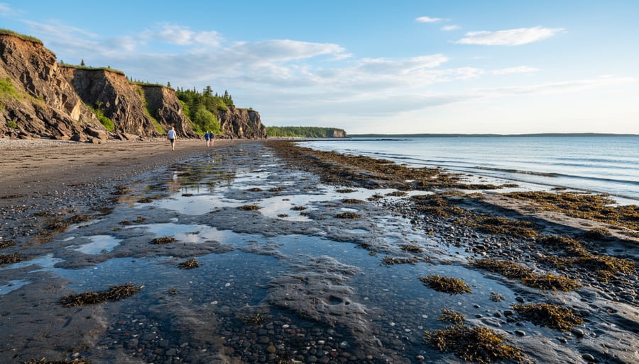
Cap-à-l’Orignal loop stands out among Quebec City area trails for one defining characteristic: you can only hike it during summer months when the tide permits safe passage along its 6 km coastal route. This unique tidal dependency transforms what could be a straightforward loop into a carefully orchestrated adventure that rewards proper planning with dramatic shoreline scenery you won’t find on inland trails.
The coastal character of this trail delivers something different from the valley and forest hikes that dominate the region. You’ll traverse rocky shoreline sections where the St. Lawrence River meets rugged cliffs, with views that shift constantly as you round each headland. The summer-only access window means the trail sees less traffic than year-round options, and the low-tide requirement creates a natural rhythm to your hike that forces you to slow down and work with nature’s schedule rather than against it.
For trip planning, you’ll need to consult tide charts for the specific date you want to hike. Aim to start your hike two to three hours before low tide, which gives you a comfortable buffer to complete the 6 km loop and return before water levels rise. Unlike trails where you can show up anytime, this one demands punctuality. Bring waterproof boots even in dry weather since shoreline sections can retain moisture from previous tides, and pack your phone or GPS in a waterproof case in case unexpected spray kicks up from the river.
4. Additional Jacques-Cartier Trails, Best for Trail Network Variety
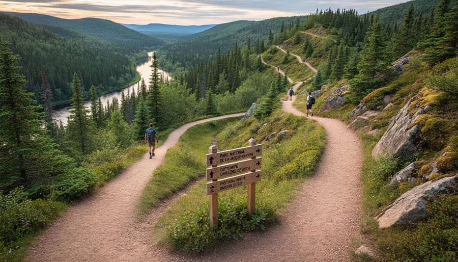
Parc national de la Jacques-Cartier’s 100-plus kilometres of trails form an interconnected network that genuinely accommodates everyone, from kids on their first forest walk to backpackers planning multi-day expeditions. Beyond the celebrated Loups trail, you’ll find dozens of lesser-known routes threading through the same glacial valley landscape, each offering a different perspective on the park’s signature terrain.
The network’s real strength lies in its range. Short interpretive loops run just one to three kilometres, perfect for testing your fitness or introducing children to Quebec wilderness without committing to a full-day trek. Mid-length trails stretch five to ten kilometres, ideal for afternoon adventures that build stamina while still delivering rewarding viewpoints and wildlife sightings. For serious hikers, the park maintains backcountry routes extending 15 kilometres or more, with designated camping zones that turn a day hike into an overnight or weekend journey.
What makes this variety practical is the trail system’s thoughtful design. Many routes intersect, letting you customize distance on the fly by linking shorter segments or bailing early if weather turns. The park maintains consistent trail marking across difficulty levels, so navigation skills you develop on beginner paths transfer directly to more demanding routes. This progressive structure means you can return to Jacques-Cartier repeatedly, choosing trails that match your evolving skills and available time rather than outgrowing the destination after one visit.
5. Intermediate Forest Trails, Best for Skill Building
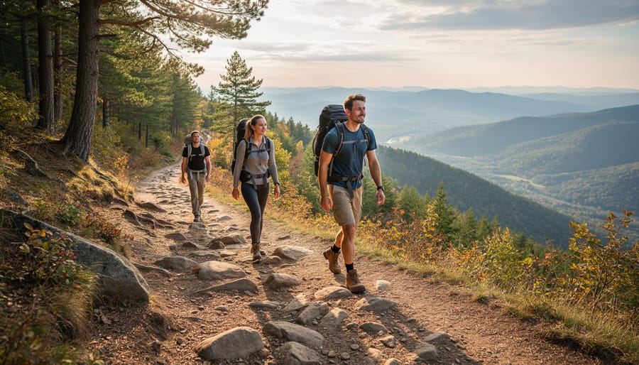
Intermediate forest trails around Quebec City give you the perfect testing ground if you’ve mastered basic loops but aren’t ready for 800-metre elevation gains. These routes typically span 8-12 km with moderate climbs between 200-400 metres, demanding enough effort to build your cardiovascular endurance without requiring technical scrambling skills.
The mid-level trails within Parc national de la Jacques-Cartier’s extensive network teach you to pace yourself over longer distances while navigating terrain that shifts from flat forest floors to steady inclines. You’ll encounter root-crossed paths, stream crossings, and sections where trail markers appear less frequently than on beginner routes, forcing you to sharpen your map-reading abilities and spatial awareness. These conditions mirror what you’ll face on advanced hikes, but with manageable consequences if you need to turn back.
What makes these trails valuable for skill development is their combination of physical challenge and mental engagement. You’re moving through dense boreal forest for extended periods, learning to gauge your water needs, test your layering system as exertion levels change, and recognize how your body responds to sustained effort. The scenery rewards your work with occasional forest clearings, rocky outcrops, and glimpses of surrounding valleys, though you won’t find the dramatic summit panoramas of the most challenging routes.
Plan on three to five hours for most intermediate forest hikes, giving yourself time to practice proper pacing and rest intervals without the pressure of racing daylight on a grueling climb.
6. Beginner-Friendly Nature Loops, Best for First-Time Quebec Hikers
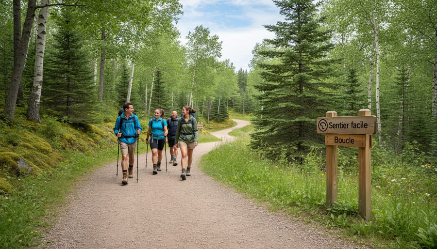
Quebec City’s beginner trails deliver exactly what first-time hikers need: clear paths, manageable distances under 5 km, and minimal elevation gain that won’t overwhelm untested legs or lungs. These loops work brilliantly for families with young children, anyone breaking in new boots before tackling steeper terrain, or hikers simply wanting a peaceful forest walk without navigation stress.
Look for trails marked as “easy” or “family-friendly” in the major park networks around Quebec City. These routes typically feature well-maintained surfaces, frequent trail markers, and gentle grades that let you focus on enjoying the scenery rather than checking your map every ten minutes. Most loop back to the same parking area, eliminating the logistics of shuttle vehicles.
These shorter trails serve as perfect testing grounds for your hiking trip planning skills. You’ll learn how quickly you cover distance, how your pack rides when loaded, and whether your layering system works for Quebec’s variable conditions, all without committing to a daylong expedition. If your gear pinches or your pacing feels off, you’re never more than an hour from the trailhead.
The accessibility factor matters for building confidence, too. Knowing you can complete the route comfortably encourages you to push slightly further next time. Many beginner loops near Quebec City also showcase the region’s forest character and river valleys in miniature, giving you a taste of what longer trails offer while keeping the physical demand reasonable for developing hikers.
7. Waterfall and River Trails, Best for Water Feature Enthusiasts
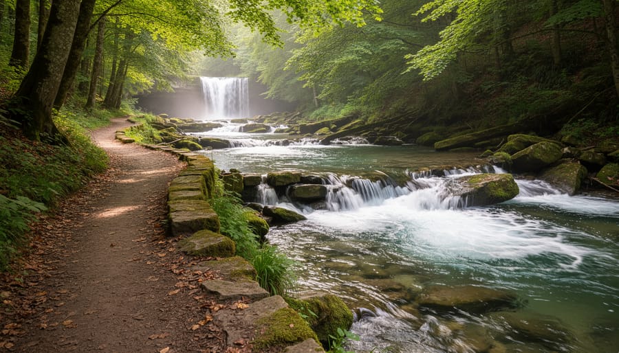
Quebec City’s river valleys deliver some of eastern Canada’s most photogenic water features, where hikers can trace rushing streams through ancient rock formations and witness waterfalls cascading over Precambrian shield cliffs. The region’s geology creates dramatic gorges where rivers have carved paths through limestone and granite over millennia, offering trails that follow these water corridors through forested terrain.
Parc national de la Jacques-Cartier stands out for waterway scenery, with multiple trails tracking the Jacques-Cartier River as it winds through its glacial valley. These routes let you walk alongside rapids and pools where the water shifts from calm stretches to whitewater sections, with the surrounding valley walls amplifying the sound of flowing water. Spring and early summer bring peak flow from snowmelt, creating the most powerful displays but also muddier trail conditions. By late summer, water levels drop to reveal more of the riverbed’s rock structure, which can be ideal for photography when you want clear reflections without spray.
The river gorge trails work well for intermediate hikers comfortable with some elevation change, as paths typically climb partway up valley walls to provide overlook perspectives. Morning light hits the water features best, creating contrast between shadowed gorge sections and sun-lit rapids. Bring a polarizing filter if you’re serious about photography, it cuts glare from wet rocks and lets you capture more detail in the water itself rather than just reflections.
8. Ridge Walk Trails, Best for Extended Views Without Extreme Climbs
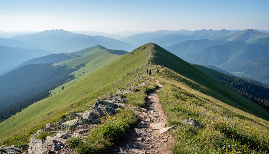
Ridge trails near Quebec City deliver panoramic rewards without the punishing climbs required for summit peaks. These routes trace elevated terrain where you gain continuous viewpoints across forests, valleys, and distant mountains while keeping elevation gain moderate, typically 200 to 400 metres spread over longer distances.
What makes ridge walks particularly appealing is the sustained scenery. Unlike summit hikes where views concentrate at a single endpoint after steep ascent, ridge routes offer shifting perspectives as you traverse undulating high ground. You’ll find these trails especially valuable during shoulder seasons when unpredictable weather makes committing to extreme elevation gain risky.
Many ridgeline paths in the Quebec City area follow natural formations where ancient geological processes created extended plateaus. The gentler gradient means you can maintain a steady pace while still experiencing the sense of elevation and exposure that makes mountain hiking rewarding. Pack your hiking essentials and consider bringing trekking poles for balance on rocky sections, as ridge terrain often features exposed bedrock and loose stones.
Look for trails described as “plateau hikes” or “scenic traverses” when researching options. These routes typically require 3 to 5 hours to complete and suit hikers who’ve graduated from beginner loops but aren’t ready for 800-metre climbs. The trade-off is distance over intensity, expect to cover 8 to 12 kilometres while enjoying extended time above the treeline.
Essential Gear for Quebec City Area Hiking
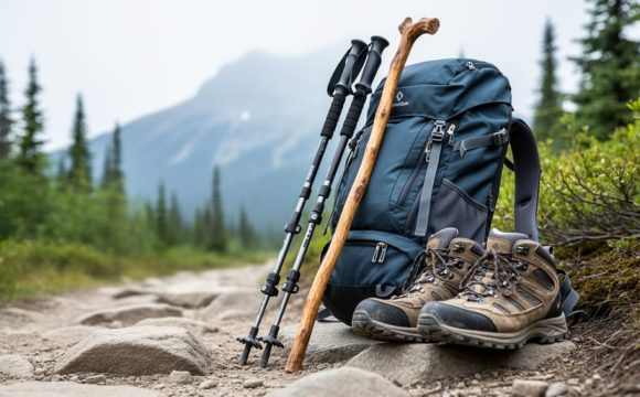
Rocky trails and coastal routes around Quebec City demand footwear with aggressive tread and ankle support, boots that grip wet granite on Jacques-Cartier’s steeper sections while staying comfortable on the 11.2 km Acropole-des-Draveurs climb. A waterproof shell is non-negotiable year-round given how quickly weather shifts in the valley terrain, and base layers should wick moisture efficiently during sustained elevation gains like that 800-metre ascent.
Your essential pack should include:
- Waterproof hiking boots with Vibram soles for rocky and root-covered trails
- Moisture-wicking base layer and insulating mid-layer for temperature swings
- Rain jacket with pit zips for ventilation during climbs
- Offline GPS device or downloaded trail maps ( cell service is unreliable in parks)
- Comprehensive first aid kit with blister treatment and emergency whistle
- Trekking poles for steep descents and stream crossings
For coastal hikes like Cap-à-l’Orignal, bring tide charts and allow extra time before low tide ends, getting caught by incoming water turns a 6 km loop into a serious problem. Navigation tools matter more on ridge walks where trail junctions aren’t always obvious, and trekking poles reduce knee strain significantly on descents after long summit pushes.
Common Questions About Hiking Near Quebec City
When is the best season to hike near Quebec City?
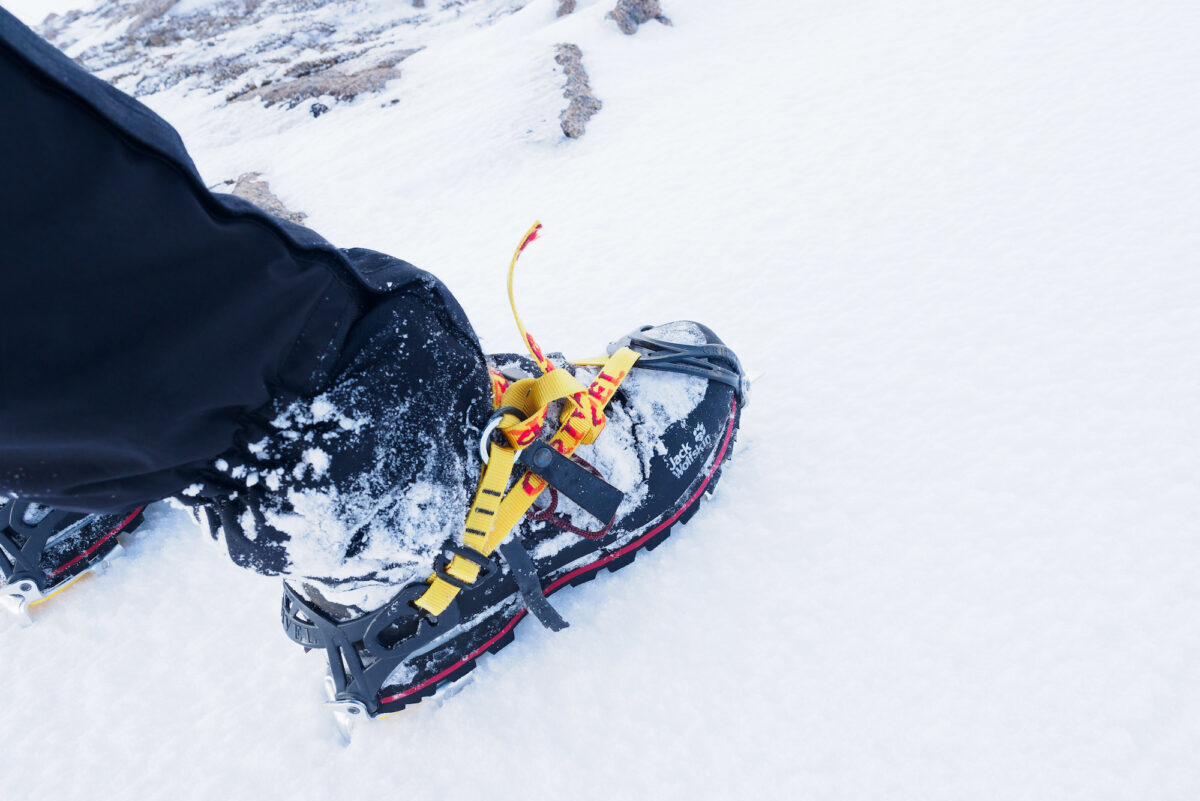
Late spring through early fall (May to October) offers the most reliable conditions, though some trails like Cap-à-l’Orignal are only accessible in summer at low tide. Winter hiking is possible but requires specialized gear and avalanche awareness in higher elevation areas.
Do you need permits for the national parks?
Yes, both Parc national de la Jacques-Cartier and Parc national des Hautes-Gorges-de-la-Rivière-Malbaie require entrance fees. You can purchase daily access passes at park gates or book online in advance during peak season.
Are the trails well-marked?
Provincial park trails are generally well-maintained with clear signage and color-coded markers. However, bringing a GPS device or downloaded offline map is smart for longer routes like the 11.2 km L’Acropole-des-Draveurs.
What wildlife should hikers expect?
Black bears, moose, and smaller mammals inhabit these forests. Carry bear spray, make noise on blind corners, and store food properly. Most wildlife encounters are benign if you maintain respectful distance.
Weather in the Quebec City region shifts quickly, especially at higher elevations. Pack extra layers even on warm days, since temperatures can drop 10-15 degrees Celsius as you gain altitude on trails like L’Acropole-des-Draveurs with its 800 metres of elevation gain. Afternoon thunderstorms are common in summer, so start early and monitor cloud build-up. Rain gear isn’t optional here; it’s standard equipment.
From tide-watching coastal adventures at Cap-à-l’Orignal to sweeping glacial valley views on the Loups trail, the Quebec City region delivers hiking variety that few other Canadian cities can match. Whether you’re testing new boots on a short forest loop or pushing through an 11.2 km summit climb, you’ll find trails that match your goals and experience.
The difference between a frustrating slog and a rewarding day comes down to honest trail selection. Use verified distance and elevation data when planning your 2026 outings, not wishful thinking about your fitness. Start with routes that suit your current abilities, then work up to the challenging ridge walks and high-elevation scrambles as your confidence grows. With over 100 km of trails at Jacques-Cartier alone, you’ve got years of exploration ahead without repeating the same path twice.