
California’s eight best hiking spots for 2026 deliver experiences ranging from oceanside canyon walks to alpine granite scrambles, each vetted for trail conditions, real-world difficulty, and seasonal accessibility. These trails span the state’s diverse terrain with concrete distance and elevation metrics, from Fern Canyon’s 0.7-mile moss-covered walls in Prairie Creek Redwoods to Lembert Dome’s 3-mile granite ascent in Yosemite’s high country. Each recommendation includes the specifics you need to plan a successful hiking trip: trailhead coordinates, documented mileage, and difficulty ratings based on California State Parks’ standardized scale where Easy means 1-2 miles with minimal elevation and Moderate jumps to 2-4 miles with terrain shifts.
We’ve tested gear performance on these exact routes, evaluating how footwear grips Yosemite’s polished granite versus the muddy root networks of coastal forests. The 2026 trail lineup prioritizes year-round access where possible, with detailed notes on routes like Whiskeytown Falls (3 miles outside Redding) that stay open when higher-elevation alternatives close. You’ll find objective assessments of what makes each trail worth the drive, whether you’re chasing waterfall spray in spring or seeking solitude on less-traveled paths that still deliver California’s signature landscapes without the crowds.
How We Chose These Hiking Spots
We selected these eight California trails by focusing on variety, accessibility, and real-world performance across different skill levels. Each spot earned its place through a combination of scenic quality, trail condition reliability, diverse terrain types, and proven popularity within the hiking community. The goal was to build a list that serves beginners looking for their first summit and experienced trekkers seeking alpine challenges alike.
Trail accessibility mattered. We prioritized routes with clear trailheads, manageable approach logistics, and year-round or extended-season access. Scenic variety was equally important, coastal bluffs, waterfall destinations, granite domes, and alpine lakes all made the cut to showcase California’s geographic range. We also evaluated objective performance factors: elevation profiles, trail surface conditions, route-finding clarity, and how terrain characteristics affect gear choices and pacing.
Difficulty ratings anchor the entire selection process. By including Easy options like McWay Falls alongside Strenuous climbs like Potato Chip Rock, we cover the full spectrum of hiking trip planning scenarios. You’ll find straightforward family-friendly walks, moderate day hikes that build stamina, and demanding routes that test endurance. This range ensures you can match a trail to your current fitness level, available time, and adventure goals without guessing whether you’re in over your head or undershooting your capabilities.
1. Lembert Dome, Yosemite National Park
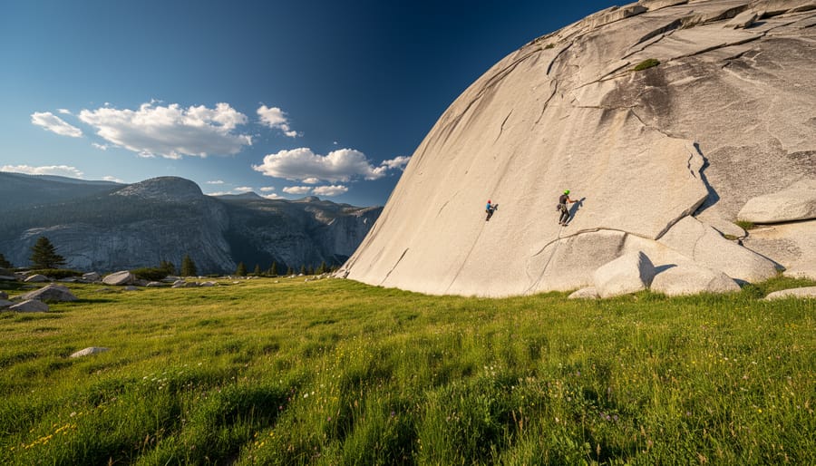
Lembert Dome delivers one of Yosemite’s most rewarding moderate climbs, clocking in at around 3 miles round trip with roughly 850 feet of elevation gain. The trail begins near Tuolumne Meadows and follows a well-defined granite path before transitioning to open rock scrambling as you approach the summit.
The terrain shifts from dirt and scattered boulders to smooth, angled granite that requires careful footing but no technical climbing skills. Rubber-soled hiking boots with good tread perform best on the dome’s polished surface, especially during early morning when dew can make the rock slick. The final push involves a moderate scramble up the dome’s slanted face, where you’ll use your hands for balance on steeper sections.
Reaching the summit rewards you with 360-degree panoramic views across Tuolumne Meadows’ sprawling alpine landscape, with Cathedral Peak and Mount Dana dominating the eastern skyline. The high-elevation setting makes this an ideal spot for learning in nature and understanding Yosemite’s glacial geology firsthand, the dome’s shape resulted from ancient ice sheets carving and polishing the granite.
Plan this hike for late June through October when Tioga Road opens and snow clears from the trail. Summer afternoons bring predictable thunderstorms, so start early and carry a lightweight rain shell. Bring at least two liters of water per person, since the exposed summit offers no shade and the 8,600-foot elevation intensifies dehydration. Trekking poles help on the descent when your quads are tired from controlling your speed on the granite slope.
2. Fern Canyon Trail
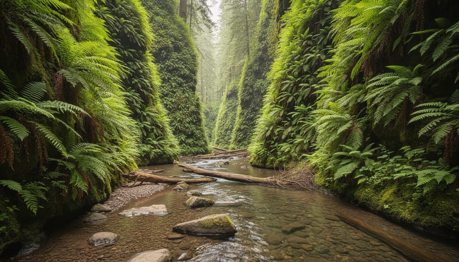
Fern Canyon delivers one of California’s most distinctive trail experiences without demanding technical skill or peak fitness. This 1-mile loop winds through a narrow gorge where 50-foot vertical walls disappear beneath cascading ferns, sword ferns, and five-finger ferns that thrive in the perpetual moisture and filtered light. The canopy overhead and the constant drip of water create an atmosphere that feels more prehistoric than modern California, it’s the kind of place that justifies the drive to the remote northern coast.
The trail follows Home Creek through the canyon floor, requiring several stream crossings that keep your feet engaged even on this short route. During drier months you can hop across on strategically placed logs and stones; after heavy rain or spring snowmelt, expect to wade through shallow water. Waterproof hiking boots prove their worth here, though many families tackle it in trail runners they don’t mind getting wet. The terrain stays level with minimal elevation change, earning an Easy to Moderate rating depending on current water levels.
What makes Fern Canyon family-friendly is its brevity combined with constant visual interest. Kids stay engaged hopping between rocks, spotting salamanders in the creek, and running hands along the fern-draped walls. The loop takes 30-60 minutes at a relaxed pace, leaving energy for exploring nearby beaches at Prairie Creek Redwoods State Park. Accessibility requires planning, the trailhead sits at the end of an unpaved road that occasionally closes during winter storms, but the payoff is a trail experience unlike anything else on this list.
3. Whiskeytown Falls, Whiskeytown National Recreation Area
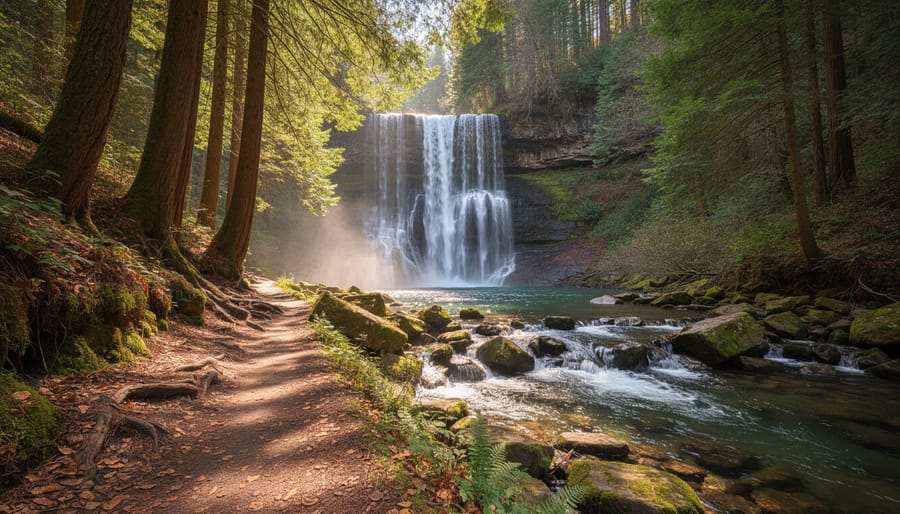
Whiskeytown Falls delivers a compact waterfall experience about 45 minutes outside of Redding, making it an accessible choice for hikers exploring Northern California. This 3-mile out-and-back trail earns a Moderate difficulty rating due to consistent uphill sections and rocky terrain, though the distance remains manageable for most hikers with basic fitness.
The trail winds through mixed oak woodland and crosses seasonal streams before reaching the 220-foot waterfall. Expect steady elevation gain throughout, roughly 400 feet over the route, with some exposed switchbacks and uneven footing. The path narrows in sections where tree roots cross the trail, requiring attention to foot placement rather than technical scrambling.
Waterflow peaks in spring and early summer, typically March through June, when snowmelt and rainfall create the most dramatic cascade. By late summer, the falls often reduce to a trickle, though the hike remains worthwhile for the forest scenery and solitude. Check current conditions before visiting, as waterflow directly affects the payoff at the destination.
Gear that performs well here includes mid-cut hiking boots with aggressive tread for the rocky sections and downhill control on the return. Trekking poles help on the steeper grades, particularly when the trail gets dusty in drier months. Bring more water than the short distance suggests, the elevation gain and limited shade make hydration essential, especially May through September.
The trailhead offers basic parking and restroom facilities, though spaces fill quickly on weekends. Starting early provides cooler temperatures and better parking availability.
4. Mount Tamalpais via Steep Ravine Trail
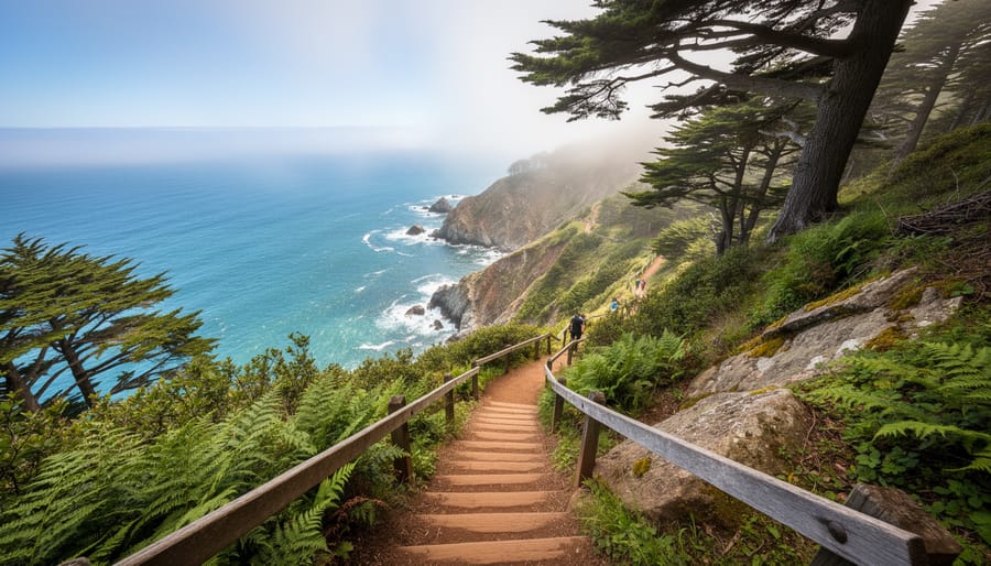
Mount Tamalpais via Steep Ravine Trail rewards intermediate hikers with one of the Bay Area’s most dramatic coastal mountain experiences. This 4.2-mile loop combines significant elevation gain, roughly 1,600 feet, with unique terrain features that push it into the Moderate to Strenuous range depending on your fitness level.
The trail’s defining characteristic is its ladder sections. You’ll climb 10-foot wooden ladders bolted into steep ravine walls as you ascend through a narrow, fern-lined canyon. Creek crossings and root-tangled terrain require steady footing and deliberate pace. The climb demands focus, but the payoff justifies the effort: summit views stretch across the Pacific, revealing the Marin Headlands, San Francisco Bay, and on clear days, the Farallon Islands 30 miles offshore.
Start at the Pantoll Ranger Station trailhead. The route descends briefly before entering Steep Ravine proper, where redwoods give way to exposed coastal scrub as you gain elevation. The trail alternates between shaded forest and sun-baked switchbacks, making layered clothing essential. The final push to the East Peak summit adds another mile if you’re chasing the 2,571-foot high point, though many hikers find the ravine itself the most memorable section.
This trail suits hikers comfortable with uneven terrain and sustained climbing. Wear grippy boots, wet wood ladders get slick, and loose rocks line the upper sections. Carry more water than the distance suggests; the elevation gain and sun exposure increase demands beyond what a typical 4-mile loop requires.
5. Potato Chip Rock via Mount Woodson Trail
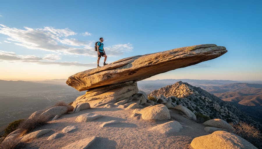
The Mount Woodson Trail to Potato Chip Rock stands out as one of San Diego County’s most challenging and photographed hikes. This roughly 7.5-mile round trip climb demands stamina and preparation, earning its Strenuous difficulty rating through a relentless 2,000-foot elevation gain over exposed, rocky terrain.
The trail ascends steadily from Lake Poway, winding through chaparral-covered hillsides with minimal shade. Granite boulders and uneven surfaces require careful foot placement, especially on the descent when fatigue sets in. The payoff comes at the summit: a thin rock slab jutting from the mountainside that resembles a potato chip, creating an iconic photo opportunity with valley views stretching below.
Plan for crowds. Potato Chip Rock attracts hundreds of hikers on weekends, and you’ll likely wait 20-30 minutes for your turn on the rock. Starting at sunrise reduces both congestion and heat exposure, which becomes oppressive on this shade-free route during warmer months.
Essential gear includes sturdy hiking boots with ankle support for the rocky sections and at least two liters of water per person, dehydration accounts for many rescues here. Trekking poles help manage the steep grade, and sun protection is non-negotiable given the full exposure. Check weather forecasts before heading out, as rain makes the granite slabs dangerously slick.
This hike rewards fit, experienced hikers willing to push through discomfort for spectacular views and that memorable summit photo.
6. McWay Falls Trail, Julia Pfeiffer Burns State Park
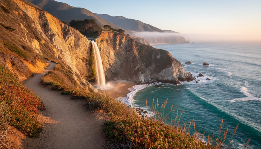
McWay Falls Trail delivers one of California’s most photogenic hiking rewards with minimal effort, making it a standout choice for beginners or anyone prioritizing scenery over distance. The trail measures just 0.6 miles round trip and sits firmly in the Easy category: flat, paved sections with well-maintained dirt paths and gentle grades that accommodate most fitness levels. Elevation gain barely registers, so you won’t need technical footwear or trekking poles, comfortable walking shoes handle the route easily.
The trail follows a short loop through Julia Pfeiffer Burns State Park, leading to an overlook platform where McWay Falls drops 80 feet from the cliff directly onto the sandy beach below (or into the Pacific during high tide). The waterfall’s year-round flow and coastal backdrop create a striking visual you can reach within 15 minutes of leaving the parking area. Accessibility features include paved segments and minimal obstacles, though the final overlook area has stairs and uneven footing that may challenge wheelchairs.
This hike works exceptionally well for trip planning when you want a guaranteed payoff without committing to hours on the trail. Families with young children, photographers chasing golden hour light, or hikers recovering from more strenuous outings all benefit from the low-risk, high-reward equation. The Big Sur location means you can pair it with coastal drives or other short trails in the same day. Arrive early during peak season to secure parking, the compact lot fills quickly, especially on weekends when visitors discover just how achievable a stunning trail experience can be.
7. Lakes Trail to Pear Lake, Sequoia National Park
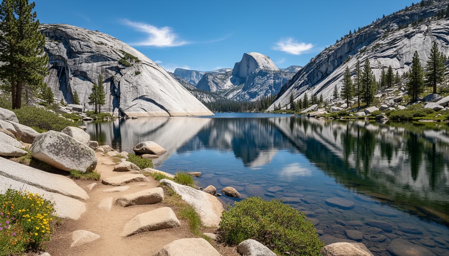
The Lakes Trail to Pear Lake spans 12-14 miles round trip and climbs roughly 2,300 feet through Sequoia’s high country, earning a Strenuous difficulty rating. The trailhead sits at Wolverton (7,200 feet elevation), and you’ll reach Pear Lake at 9,500 feet, which means acclimatization matters if you’re coming from lower elevations.
You’ll pass through mixed conifer forest before breaking into open granite basins dotted with wildflower meadows in early summer. The trail crosses several seasonal streams, then climbs steadily to reveal polished granite slabs and distant views of the Great Western Divide. Pear Lake itself sits in a cirque surrounded by steep rock faces, with clear water cold enough to numb your hands in seconds.
Weather shifts quickly at this elevation. Morning sun can turn to afternoon thunderstorms, and temperatures drop sharply once you’re above treeline. Layering becomes critical: a moisture-wicking base layer, insulating mid-layer, and waterproof shell handle the swings. Well-ventilated hiking caps help manage sun exposure on exposed granite sections, where shade disappears for long stretches.
Trekking poles reduce knee strain on the descent, and boots with ankle support handle the rocky, uneven terrain better than trail runners. Carry extra water capacity since stream crossings become less frequent as you climb. The trail stays open from June through October depending on snowpack, but snow can linger on north-facing slopes into July. Pack for variable conditions rather than the forecast alone.
8. Torrey Pines State Natural Reserve Loop
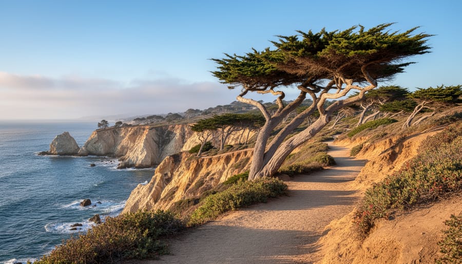
Torrey Pines State Natural Reserve delivers ocean-view hiking just 20 minutes north of downtown San Diego, combining accessible coastal trails with rare ecology. The reserve offers three main loops, Beach Trail, Guy Fleming Trail, and Parry Grove Trail, each rated Easy to Moderate and covering 0.7 to 1.5 miles. You can link these trails for a 2-4 mile hike that suits everything from a quick morning walk to a half-day exploration, making this spot unusually adaptable for different fitness levels and camping trip planning schedules.
The real draw here is the layered terrain: sandstone bluffs rising 300 feet above the Pacific, narrow trails through scrubland, and overlooks where you can watch hang gliders launch from the cliffs. The reserve protects one of the rarest pine species in North America, Torrey pines grow naturally only here and on Santa Rosa Island. You’ll spot their twisted, weathered silhouettes against the sky as you walk the ridgeline trails.
Trail surfaces range from packed dirt to eroded sandstone, occasionally steep but brief enough that beginners handle them fine. Switchbacks on the Beach Trail descend to sand level, while the upper loops stay on the bluffs. Bring sun protection, shade is minimal, and check safety tips for coastal conditions before you go, especially on windy days when the bluff edges require extra caution. This reserve works well for families, solo hikers seeking shorter distances, or anyone wanting coastal scenery without committing to a full-day trek.
Gear That Performed Best on These Trails
Across California’s diverse trail conditions, from Fern Canyon’s creek crossings to Lembert Dome’s granite slopes, certain gear categories proved essential for handling varied terrain and distance requirements.
- Hiking boots with ankle support and aggressive tread patterns handled both slick rock surfaces and loose dirt trails, particularly on elevation climbs where foot placement matters most
- Hydration systems scaled to distance: 1-2 liter capacity for short coastal walks like McWay Falls, 3 liters minimum for strenuous climbs like Potato Chip Rock where water sources are absent
- Trekking poles reduced knee strain on steep descents and provided stability on uneven surfaces, proving most valuable on trails with significant elevation gain above 1,000 feet
- GPS navigation tools or downloaded offline maps addressed spotty cell service in remote areas like Sequoia’s backcountry and Whiskeytown National Recreation Area
Performance testing revealed that gear requirements shift based on trail difficulty ratings and environmental factors. Moderate trails like the 3-mile Whiskeytown Falls route demanded different footwear than strenuous alpine approaches, where temperature swings and exposed rock required layering systems and sun protection. Matching gear to specific trail conditions prevents both over-packing and under-preparation during hiking trip planning, letting you focus on the experience rather than equipment struggles.
Planning Your California Hiking Adventure
California’s trail diversity means every hiker can find their ideal match in 2026, whether you’re seeking an easy coastal walk at McWay Falls or a strenuous alpine challenge at Pear Lake. The eight trails covered here span the full difficulty spectrum, from beginner-friendly loops under two miles to demanding climbs exceeding 10 miles with significant elevation gain.
Before you hit the trail, check current conditions through official park websites or ranger stations, as seasonal factors like snowmelt, fire closures, and storm damage can alter accessibility without warning. The right preparation makes the difference between a frustrating outing and a rewarding adventure. Thorough hiking trip planning, from realistic trail selection based on your experience level to packing tested, reliable gear, ensures you’ll spend more time enjoying California’s remarkable landscapes and less time dealing with avoidable setbacks.
Frequently Asked Questions
What is the best time of year to hike in California?
Spring and fall typically offer the most comfortable conditions across most California trails, with moderate temperatures and fewer crowds. Summer works well for high-elevation hikes in the Sierra Nevada, while coastal trails remain accessible year-round, though winter storms can temporarily close some paths.
Do I need permits for these trails?
Permit requirements vary by location. National parks like Yosemite and Sequoia may require wilderness permits for overnight trips or parking reservations for popular trailheads, while day hikes in state parks and recreation areas typically only need standard entry fees. Check the managing agency’s website for the specific trail you’re planning to visit.
What difficulty rating is best for beginners?
Beginners should start with Easy-rated trails, which typically cover 1-2 miles with minimal elevation gain on well-maintained paths. Once comfortable, you can progress to Moderate trails that span 2-4 miles with some terrain variation and modest elevation changes.
How do I know if a trail is currently open?
Visit the official website or call the ranger station for the park or recreation area managing the trail. Many agencies post current trail conditions, seasonal closures, and temporary restrictions online, and ranger staff can provide real-time updates on accessibility and safety concerns.
These questions come up frequently when hikers start researching California trails, and having clear answers helps you plan more confidently. Trail conditions change with weather, wildfire recovery, and maintenance schedules, so verifying current status before you head out prevents wasted trips and ensures you’re prepared for what you’ll encounter on the ground.