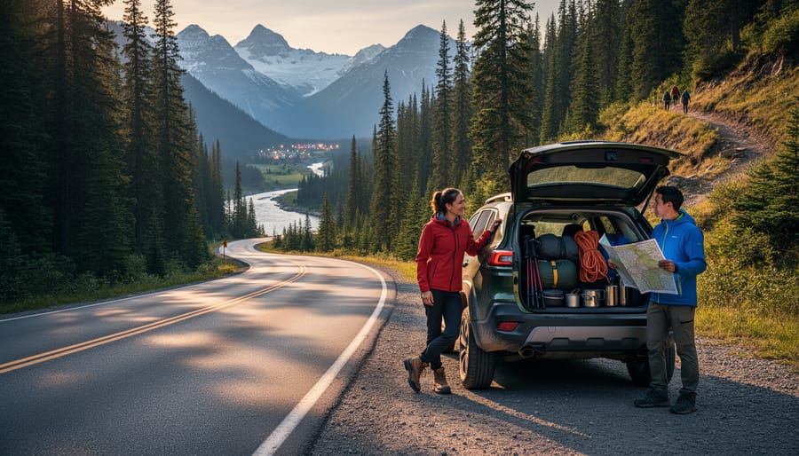

North America’s most scenic road trip routes span over 50,000 miles of pavement that cut through six distinct ecosystems, from Pacific coastlines to alpine passes, offering outdoor adventurers direct access to world-class hiking, camping, and climbing destinations. The best routes combine jaw-dropping scenery with proximity to trailheads, established campgrounds, and adventure zones you can reach within minutes of pulling over.
We’ve tested these routes firsthand, logging thousands of miles across different seasons to evaluate road conditions, campsite quality, and adventure accessibility. What makes a route worthy of your 2026 road trip calendar? It needs reliable infrastructure, diverse activity options within a day’s drive, and landscapes that shift dramatically enough to keep you engaged mile after mile.
The 12 routes featured here range from weekend getaways to month-long expeditions. Each one has been selected based on outdoor recreation density, scenic variation, and practical considerations like fuel availability and gear resupply points. Whether you’re planning your first cross-country adventure or your fifteenth, you’ll find specific route details, standout activities along each corridor, and the essential gear that makes the difference between a frustrating trip and an unforgettable one.
How We Selected These Routes
We didn’t just throw together a list of famous highways and call it a day. Each route in this guide earned its spot through a rigorous evaluation process that mirrors how we test gear, objective criteria, real-world assessment, and a focus on what actually matters for outdoor adventurers.
Our selection framework prioritized routes that deliver genuine outdoor adventure potential, not just pretty views from behind a windshield. We evaluated each candidate route across six core criteria:
- Outdoor activity access, quality and variety of camping, hiking, climbing, and biking opportunities within easy reach of the route
- Scenic value, visual impact and landscape diversity that makes the drive itself an experience
- Road conditions and accessibility, pavement quality, vehicle requirements, and navigability for typical road trippers
- Camping infrastructure, availability of established campgrounds, dispersed camping options, and backcountry access
- Seasonal considerations, optimal timing, weather patterns, and year-round vs. limited-season accessibility
- Overall adventure potential, the combination of factors that create memorable outdoor experiences beyond just driving
Routes that excelled in outdoor activity access got priority over those that were merely scenic. A stunning coastal drive without decent camping or trail access didn’t make the cut, while routes offering world-class hiking and climbing alongside beautiful scenery rose to the top.
We also considered geographic diversity to give you options across the continent, from coastal California to the Canadian Rockies. Each route offers something distinct, whether that’s desert solitude, alpine adventure, or maritime exploration, so you can match your trip to your outdoor interests and skill level. The goal was to identify routes where the journey and the adventures along the way are equally compelling.
The Best North American Road Trip Routes
Pacific Coast Highway (California)
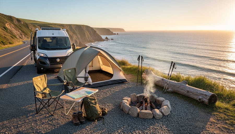
California’s Highway 1 stretches 650 miles down the coast, delivering continuous ocean views and access to some of the state’s best outdoor experiences. The route winds through Big Sur’s dramatic cliffs, Santa Barbara’s Mediterranean-style beaches, and countless pull-offs where you can pitch a tent within earshot of crashing waves.
For camping, Kirk Creek Campground sits on bluffs 100 feet above the Pacific, reserve early, as these 21 sites book months ahead. Pfeiffer Big Sur State Park offers more sheltered redwood camping with direct trail access. Further south, El Capitan State Beach near Santa Barbara provides beachfront sites perfect for combining surfing sessions with evening campfires.
The coastal hiking peaks at Ewoldsen Trail in Julia Pfeiffer Burns State Park, climbing 1,600 feet through redwoods before opening to sweeping ocean panoramas. Point Lobos State Natural Reserve near Carmel packs world-class tide pools and sea otter viewing into a compact four miles of trails.
Cyclists should tackle the 90-mile Big Sur section when prepared for narrow shoulders and steep grades, the reward is riding through what many consider America’s most scenic stretch of pavement. Pack layers for this drive; coastal fog can drop temperatures 20 degrees within minutes, and the marine layer often lingers until noon.
Going-to-the-Sun Road (Montana)
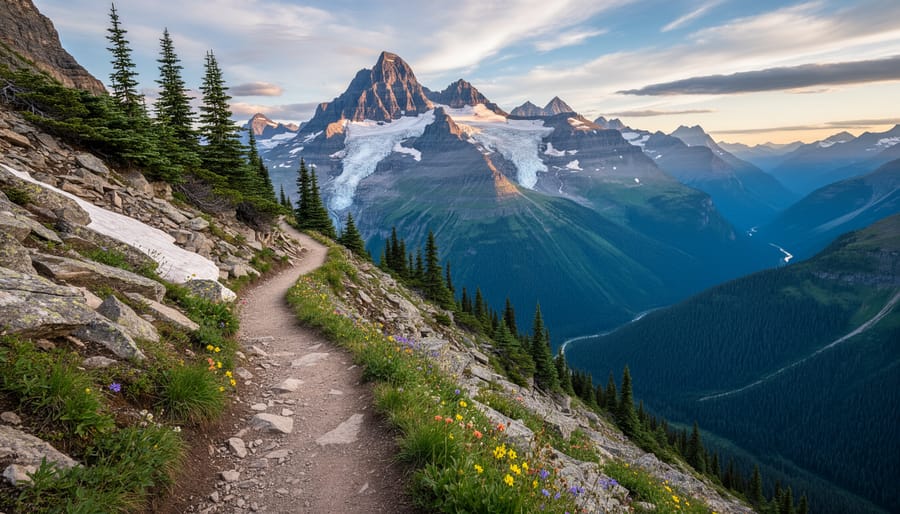
Going-to-the-Sun Road earns its dramatic name with 50 miles of alpine engineering that crosses the Continental Divide at 6,646-foot Logan Pass. This National Historic Landmark cuts through Glacier National Park’s heart, connecting Lake McDonald to St. Mary while delivering jaw-dropping mountain vistas at every hairpin turn.
The road opens to full vehicle traffic typically from mid-June through mid-October, though exact dates vary based on snowpack. Seasonal opening constraints mean spring and fall visitors should verify current conditions before heading out. Cyclists can access the road earlier during spring plowing season when sections remain closed to cars.
Thirteen campgrounds within the park offer base camps for exploration, from developed sites at Avalanche Creek and Many Glacier to backcountry permit zones for serious hikers. Logan Pass serves as the trailhead hub, with the Hidden Lake Overlook trail and Highline Trail delivering alpine meadows, wildflower displays, and mountain goat encounters within the first few miles.
Pack bear spray and layer for rapid weather shifts. Afternoon thunderstorms roll in fast at altitude, and morning starts often begin below freezing even in summer. The road’s narrow shoulders and no-guardrail sections demand confident handling, but the payoff is unmatched access to North America’s best remaining glacier-carved wilderness.
Blue Ridge Parkway (Virginia to North Carolina)
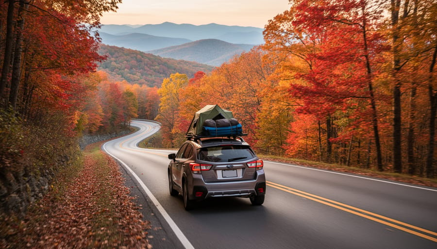
The Parkway is 469 miles long and winds through elevation changes from 649 to 6,053 feet, making it a dream for outdoor enthusiasts who want to mix driving with hiking and cycling. Unlike faster interstate routes, the 45 mph speed limit keeps you engaged with the scenery rather than rushing past it.
Camping here splits between developed campgrounds and dispersed options near the route. Linville Falls, Price Lake, and Mount Pisgah campgrounds offer established sites with amenities, but book ahead during peak fall season. For hiking access, pull-offs dot nearly every mile, trails range from easy 20-minute walks to strenuous summit climbs like Grandfather Mountain’s rugged paths.
Cyclists should tackle sections rather than the full route in one push. The Blowing Rock to Grandfather Mountain stretch offers manageable climbing with rewarding descents, while flatter segments near Roanoke suit less experienced riders. Bring lights and reflective gear since tunnels appear frequently.
Fall foliage peaks mid-October at higher elevations, shifting to early November in lower sections. Expect crowds during those weeks. Spring wildflower season in May provides an equally beautiful but quieter alternative.
Pack layered clothing for rapid temperature shifts with elevation. A quality tent stakes kit handles the rocky Appalachian soil better than standard pegs, and bear-resistant food storage is required at most campgrounds.
Alaska Highway (Canada/Alaska)
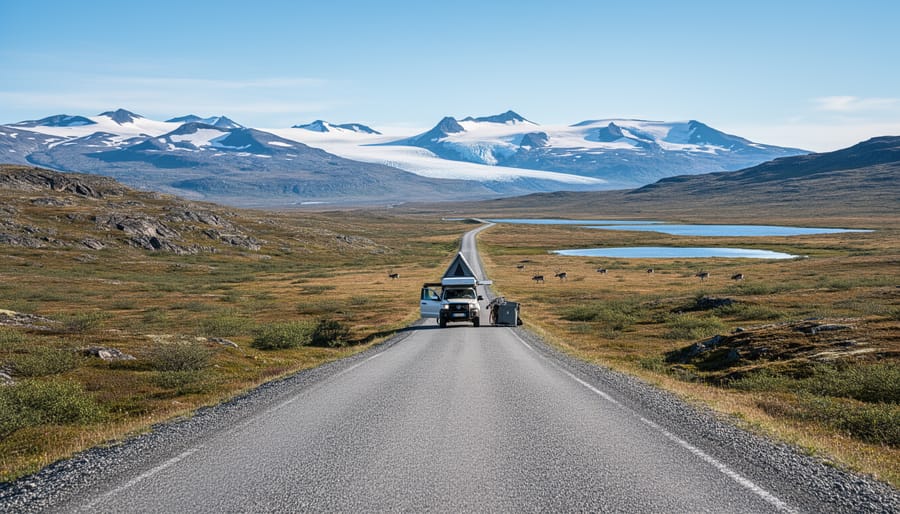
The Alaska Highway stretches 1,387 miles from Dawson Creek, British Columbia, to Delta Junction, Alaska, cutting through some of North America’s most pristine wilderness. This legendary route demands serious preparation but rewards travelers with unmatched remoteness and raw natural beauty.
Remote camping defines this journey. Provincial and territorial campgrounds dot the route every 50-100 miles, but dispersed camping along service roads offers true solitude. Carry extra fuel, gas stations can be sparse, and some towns offer limited services. Pack a comprehensive tool kit, spare tire, and emergency supplies including bear spray and satellite communication devices.
Wildlife encounters are virtually guaranteed. Grizzlies, black bears, moose, bison, and caribou frequently cross the highway. Maintain safe viewing distances (at least 100 yards for bears) and secure all food in bear-proof containers or your vehicle.
Hiking opportunities increase as you push north. Stop at Liard River Hot Springs for easy trails and a soak, or tackle more challenging routes in Kluane National Park near the highway’s end. The Sheep Mountain area offers excellent day hikes with dramatic valley views.
Plan for variable weather year-round. Even summer nights drop near freezing at northern latitudes. A four-season tent, cold-rated sleeping bag, and layered clothing system are non-negotiable for this expedition-grade adventure.
Trans-Canada Highway (Coast to Coast)
Stretching 7,821 kilometres from Victoria, British Columbia to St. John’s, Newfoundland, the Trans-Canada Highway ranks among the world’s longest national routes and delivers an unmatched cross-continental adventure. What sets this route apart is the dramatic terrain shifts: you’ll start amid Pacific coastal rainforests and the towering peaks of the Rockies, cross the vast prairies, navigate the rugged Canadian Shield, and finish on Atlantic sea cliffs.
The highway grants access to dozens of national and provincial parks. In the west, Yoho and Banff offer alpine hiking and backcountry camping just off the main route. Further east, Riding Mountain National Park in Manitoba provides prairie-to-boreal transition zones perfect for wildlife spotting and lakeside camping. Ontario’s section skirts Lake Superior’s north shore, where provincial parks like Sleeping Giant deliver dramatic hiking with Great Lakes vistas.
Provincial campgrounds dot the entire route, typically spaced every 100-200 kilometres. Book ahead during summer, especially in popular regions like the Rockies and Maritime provinces.
Cycling the Trans-Canada is increasingly popular, with dedicated shoulders in many provinces. Quebec’s section through the Laurentians and New Brunswick’s Bay of Fundy coastal stretch rank as cyclist favorites for scenery and manageable grades. Pack for all weather conditions, mountain snowstorms can hit even in summer at elevation, while Maritime fog demands visibility gear year-round.
Route 66 (Illinois to California)
Route 66 stretches 2,448 miles from Chicago to Santa Monica, and while most travelers focus on roadside diners and vintage motels, this historic highway passes through remarkably diverse outdoor terrain perfect for camping and hiking adventures.
The route’s western half offers exceptional desert camping opportunities, particularly around Arizona’s Painted Desert and New Mexico’s Cibola National Forest. Many sections traverse public lands where dispersed camping is permitted, giving you front-row seats to stunning sunsets over rugged landscapes. Pack a quality four-season tent rated for temperature swings, as desert nights drop significantly even in summer.
Petrified Forest National Park provides accessible hiking through otherworldly badlands, while the trail network around Flagstaff connects you to ponderosa pine forests at 7,000 feet elevation. Further west, the Mojave Desert sections near Amboy Crater offer short but striking volcanic hikes.
The route’s charm lies in blending nostalgia with genuine wilderness access. You can photograph a classic neon sign in the morning, then spend the afternoon scrambling through slot canyons near Oatman. This combination makes Route 66 ideal for travelers who want outdoor adventure without abandoning the comforts of civilization entirely. Bring layered clothing systems to handle elevation changes from prairie to high desert to coastal zones.
Million Dollar Highway (Colorado)
The Million Dollar Highway earns its name through sheer vertical drama, this 25-mile stretch of US-550 between Silverton and Ouray climbs through 11,000-foot passes with thousand-foot drops just feet from your wheels. No guardrails soften the exposure on many sections, making this Colorado San Juan Skyway segment an adrenaline rush before you even leave the car.
Base yourself in Ouray or Silverton for high-altitude camping at 9,000+ feet. The area’s old mining roads now serve mountain bikers chasing technical descents, while hikers can tackle Ice Lakes Basin for alpine tarns or push toward Chicago Basin’s fourteeners. Rock climbers head to Ouray Ice Park in winter or test traditional routes on the surrounding peaks during summer months.
Your gear list needs altitude adjustments. A four-season tent handles sudden weather shifts above treeline, even in July. Pack layers rated for freezing overnight temps and afternoon sun within the same day. A headlamp with extra batteries matters when storms roll in early. Water filtration becomes critical since high camps often sit near snowmelt streams rather than developed sites.
Plan this route for late spring through early fall. Winter closures shut down the highway, and afternoon thunderstorms are standard issue from June through August. Acclimatize at lower elevations first, altitude sickness derails more trips here than technical difficulty.
The Loneliest Road (Nevada)
Highway 50 cuts 287 miles across Nevada’s high desert, earning its “Loneliest Road” nickname from sparse services and vast empty spaces between towns. What looks like desolation on a map translates to extraordinary freedom on the ground, this route offers some of America’s best dispersed camping, with endless public land where you can pull off and set up camp wherever looks promising.
The basin-and-range topography creates a rhythm of valleys and mountain passes, each basin offering different hiking possibilities. Great Basin National Park sits near the route’s eastern end, providing established trails to bristlecone pine groves and alpine lakes, but the real adventure lies in exploring the unnamed ranges between Ely and Fallon. Bring detailed topo maps and plenty of water, distances are deceiving in this terrain.
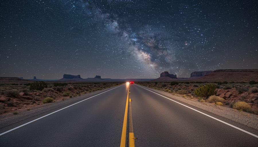
Stargazing here rivals any designated dark-sky park. With virtually no light pollution between towns, you’ll see the Milky Way’s full arc and satellites tracking across crystal-clear skies. Late spring and fall offer comfortable temperatures; summer days exceed 100°F while winter brings snow to higher elevations.
Essential gear includes serious water capacity (one gallon per person daily minimum), a dependable cooler, tire repair kit, and recovery boards for soft desert soil. Cell service vanishes for hundred-mile stretches, making offline navigation and emergency supplies non-negotiable.
Cabot Trail (Nova Scotia)
The Cabot Trail delivers 185 miles of dramatic coastal scenery as it loops around Cape Breton Highlands National Park in Nova Scotia. This maritime route combines rugged cliffsides, lush valleys, and sweeping ocean views with accessible outdoor adventures along the Gulf of St. Lawrence and Atlantic coastline.
Ocean-side camping defines the Cabot Trail experience. The park’s Chéticamp and Broad Cove campgrounds sit near the water, offering direct access to coastal trails and beach walks. Many travelers prefer late spring through early fall when weather cooperates and facilities stay open. Private campgrounds in small fishing villages like Pleasant Bay provide additional options with ocean views.
The trail itself challenges cyclists with steep climbs rewarded by extended downhill runs and ocean panoramas. French Mountain’s ascent tests fitness levels, while the descent toward Pleasant Bay ranks among Canada’s most scenic cycling segments. Bring low gears and functional brakes for this route.
Hiking ranges from easy coastal walks to challenging backcountry trails. The Skyline Trail offers sunset views over the Gulf, and coastal paths near Ingonish reveal hidden beaches and tide pools. Whale watching peaks from June through October, with pilot whales, minkes, and occasional humpbacks visible from clifftop viewpoints or charter boats departing Pleasant Bay.
Beartooth Highway (Montana/Wyoming)
The Beartooth Highway climbs to 10,947 feet through some of the most dramatic alpine terrain in the Lower 48. This 68-mile stretch of U.S. Route 212 connects Red Lodge, Montana, to the northeast entrance of Yellowstone National Park, traversing a landscape of glacial lakes, snowfields, and tundra that rivals anything you’ll find in Colorado.
Plan your trip between late May and mid-October, snow typically closes the highway the rest of the year. Even in summer, prepare for sudden weather shifts. I’ve experienced 70-degree sunshine at the base and near-freezing winds at Beartooth Pass within the same afternoon.
Camping options include developed sites at Island Lake and Beartooth Lake, both offering stunning high-altitude settings with trout fishing access. For backcountry enthusiasts, dispersed camping is permitted in the surrounding Shoshone National Forest, though you’ll want a four-season tent rated for alpine conditions.
The fishing here is exceptional. Native Yellowstone cutthroat and brook trout populate dozens of alpine lakes accessible by short hikes from pullouts. Pack a lightweight rod and focus on lakes beyond the immediate roadside for better catches.
Essential gear includes layers for rapid temperature changes, a quality camp stove (campfires are restricted above treeline), and altitude sickness medication if you’re coming from sea level.
Utah’s Mighty 5 Circuit (Utah)
Utah’s Mighty 5 Circuit delivers one of the most concentrated doses of desert adventure in North America, linking Zion, Bryce Canyon, Capitol Reef, Canyonlands, and Arches in a single epic loop of roughly 600 miles. This route transforms road-tripping into a multi-park expedition through some of the Southwest’s most dramatic red rock landscapes.
Camping strategies matter here. Reservations at park campgrounds fill months ahead for spring and fall, so many adventurers mix in BLM dispersed camping outside park boundaries or use private campgrounds in gateway towns like Moab and Springdale. Capitol Reef’s Fruita Campground offers a quieter midpoint, while dispersed sites along Highway 12 between Bryce and Capitol Reef provide stunning off-grid options.
Each park delivers distinct hiking. Zion’s Narrows and Angels Landing challenge you with water wading and exposure, Bryce’s hoodoo forests feel otherworldly on the Fairyland Loop, and Canyonlands’ backcountry rewards experienced hikers willing to carry extra water. Slot canyons like Zebra and Little Wild Horse near Capitol Reef add technical scrambling to the mix.
Desert gear essentials include a high-capacity hydration system carrying at least 3 liters per person, sun protection that actually works in high-elevation desert sun, and layers for the 40-degree temperature swings between dawn and midday. Traction devices help on Zion’s steep sandstone, while approach shoes handle slot canyon scrambling better than traditional hikers.
Icefields Parkway (Alberta)
The 143-mile Icefields Parkway connecting Jasper and Banff ranks among the world’s most spectacular mountain drives, threading through glacier-carved valleys with the Canadian Rockies towering on both sides. You’ll pass 25 named glaciers visible from the road, including the massive Athabasca Glacier where you can walk onto ancient ice at the Columbia Icefield Glacier Discovery Centre.
Plan your hiking around classics like Parker Ridge for panoramic views of the Saskatchewan Glacier, or tackle the challenging Wilcox Pass trail for close-up looks at the Columbia Icefield from above. The Mistaya Canyon and Sunwapta Falls offer quick roadside stops with short walks to dramatic water features. Serious backpackers should explore the multi-day routes in the Skoki region accessible from Lake Louise.
Camping requires advance reservations at Parks Canada campgrounds like Wilcox Creek near the icefields or the larger Waterfowl Lakes with electric sites. Arrive early in summer, spots fill fast, and store all food in bear-proof lockers provided at each site. Wildlife safety guidance from Parks Canada emphasizes carrying bear spray within reach and making noise on trails, especially in dense vegetation along stream corridors where grizzlies feed.
Pack layers for unpredictable mountain weather, it can snow any month, plus quality rain gear and insulated clothing even in July. A good telephoto lens captures wildlife from safe distances, and binoculars enhance spotting sheep and goats on cliff faces. The parkway typically opens fully by mid-June and closes sections by October depending on snowfall.
Essential Gear for Road Trip Adventures
Vehicle-based road tripping demands a different gear strategy than backpacking. You need robust equipment that maximizes comfort without obsessing over every ounce, plus reliable tools that handle diverse conditions across thousands of miles.
Start with a quality four-season tent sized for your group, preferably freestanding for flexibility on hard-packed campground sites. A sleeping bag rated 10-15 degrees below your expected low temperatures provides a safety buffer, and a thick sleeping pad transforms rocky ground into a decent night’s rest. For cooking, a two-burner camp stove beats single-burner backpacking models when you’re not carrying everything on your back, faster boil times and room for a pan and pot simultaneously make multi-course meals practical.
Storage systems keep your vehicle organized and gear accessible. Roof boxes or rear cargo carriers expand capacity for bulky items like chairs and coolers, while clear plastic bins inside the vehicle let you find what you need without unpacking everything. A quality cooler that holds ice for multiple days cuts grocery stops and keeps perishables safe in remote stretches.
Navigation tools should include offline GPS capability, apps like Gaia GPS or onX Offroad download maps before you lose signal. Carry physical road atlases too; screens fail, batteries die, and paper works everywhere. For safety, pack a comprehensive first aid kit, emergency blanket, headlamps with extra batteries, fire starter, multi-tool, duct tape, and a portable phone charger with solar capability.
Activity-specific gear depends on your route. Hiking demands sturdy boots, trekking poles, and a daypack with hydration system. Cyclists need a bike rack, basic repair kit, pump, and helmet. Climbers require harness, rope, quickdraws, helmet, and approach shoes, though rental gear near climbing areas saves space for casual attempts. Layered clothing systems handle temperature swings from desert mornings to mountain afternoons: moisture-wicking base layers, insulating mid-layers, waterproof shells.
Don’t forget mundane essentials that make or break trip comfort. Camp chairs, a table, quality headlamp, bear-proof food storage (required in many parks), and a dependable water filtration system turn roadside camps into genuine retreats rather than grim survival exercises.
What to Remember
From rugged Pacific shores to alpine passes that touch the clouds, these twelve routes prove that North America’s greatest outdoor adventures unfold between destinations, not just at them. Whether you’re a weekend warrior looking for your first camping trip or an experienced adventurer planning a months-long expedition, there’s a route here that matches your skill level and appetite for exploration.
The beauty of road trip planning is the flexibility. You can tackle the entire Trans-Canada Highway in one epic journey or break the Pacific Coast Highway into weekend segments. You can chase fall colors down the Blue Ridge Parkway or time your Million Dollar Highway drive for wildflower season. Each route rewards different approaches and different ambitions.
What’s the best season for North American road trips?
Summer (June through August) offers the most accessible conditions for most routes, though spring and fall provide fewer crowds and stunning seasonal displays. High-altitude routes like Beartooth Highway and Going-to-the-Sun Road are typically only fully open from late June through September.
Do I need permits for camping along these routes?
National park campgrounds and many state parks require reservations, especially during peak season. Dispersed camping on public lands (BLM, National Forest) is often free but may have restrictions. Check regulations for each specific area before you arrive.
How should I prepare my vehicle for long road trips?
Get a full mechanical inspection before departure, including brakes, tires, fluids, and battery. Carry a spare tire, basic tools, jumper cables, and emergency supplies. Remote routes like the Alaska Highway demand extra fuel capacity and emergency preparedness.
Success on any of these routes comes down to preparation. The right gear makes the difference between a memorable adventure and a miserable slog. Our expert reviews can help you choose tested, reliable equipment that performs when conditions get challenging. Start planning your route, check current conditions, and invest in quality gear that won’t let you down when you’re miles from the nearest town. The road is waiting.
items
California’s Highway 1 delivers 655 miles of coastal drama from San Francisco’s Golden Gate Bridge to San Diego’s beaches. The route hugs cliffsides above the Pacific, passing through Big Sur’s rugged terrain, Monterey’s cypress forests, and Santa Barbara’s Mediterranean-style coastline.
Camp at Andrew Molera State Park for walk-in beach sites or Julia Pfeiffer Burns for redwood shade. Reserve ahead, coastal campgrounds fill months in advance during summer. Pfeiffer Big Sur State Park offers hot showers and easy access to hiking trails through the Ventana Wilderness.
Hit the trails at Point Lobos State Reserve for coastal scrub hiking and sea otter viewing. McWay Falls provides a quick scramble to views of the 80-foot waterfall onto the beach. Serious hikers tackle the Sykes Hot Springs trail, an 11-mile trek into the backcountry with natural pools as the reward.
Cyclists love the challenge between Carmel and Big Sur, though narrow shoulders and heavy traffic demand confidence. Early morning rides beat the RV crowds. The 17-Mile Drive offers gentler pedaling through Pebble Beach.
Pack layers, coastal fog rolls in without warning, dropping temperatures 20 degrees in minutes. Bring a quality windbreaker, not just a sweatshirt. Your tent needs strong stakes for exposed campsites where ocean winds gust hard after sunset.
This 50-mile engineering marvel bisects Glacier National Park, climbing from valley floor to Logan Pass at 6,646 feet. The road opens late June through mid-October, depending on snowpack. Massive snowplows carve through drifts that can reach 80 feet deep at the pass.
Camping inside the park puts you closest to trailheads. Avalanche Campground sits among cedars near the Trail of the Cedars boardwalk. Many Glacier Campground on the east side offers the best wildlife viewing, grizzlies, mountain goats, and bighorn sheep frequent the area. No reservations for most sites; arrive by 8 AM or you’ll strike out.
The Highline Trail from Logan Pass ranks among North America’s best day hikes, 11.8 miles along the Continental Divide with goats grazing above sheer drops. Hidden Lake Overlook provides a shorter 3-mile round trip to alpine lake views. Iceberg Lake Trail rewards the 9-mile effort with floating ice chunks in August.
Cyclists can ride Going-to-the-Sun before it opens to vehicles. The park allows bikes during road clearing, typically mid-April through late June on the west side. Once open, cyclists share narrow pavement with tour buses, not for the faint of heart.
Grizzly country demands bear spray on every hike and proper food storage at camp. Sudden weather shifts at elevation require rain gear and warm layers even in July. Afternoon thunderstorms build fast over the peaks.
The Parkway stretches 469 miles along Appalachian ridgelines, connecting Shenandoah National Park to Great Smoky Mountains National Park. Unlike interstates, the 45 mph speed limit encourages stopping at overlooks every few miles. No commercial traffic means peaceful driving through hardwood forests and mountain balds.
National Park Service campgrounds dot the route, Otter Creek, Peaks of Otter, and Mount Pisgah offer full facilities. Julian Price Memorial Park provides lakeside sites perfect for kayaking. First-come sites fill by afternoon on fall weekends when leaf peepers descend.
Hiking options range from easy nature walks to challenging summit climbs. Rough Ridge Trail near Grandfather Mountain delivers 360-degree views for minimal effort. Sharp Top at Peaks of Otter climbs 1,500 feet in 1.5 miles, steep but short. Craggy Gardens explodes with rhododendron blooms in June.
The Parkway itself attracts serious cyclists despite constant elevation changes. The Virginia Creeper Trail offers an easier option, a 34-mile converted rail trail from Abingdon to Whitetop with bike shuttles available.
October draws massive crowds for fall color, peaking at different elevations from late September through early November. Higher elevations turn first. Spring offers fewer people and wildflower blooms, though some facilities stay closed until May. Pack for temperature swings, mountain weather changes hourly.
The 1,387-mile Alaska Highway pushes through genuine wilderness from Dawson Creek, British Columbia, to Delta Junction, Alaska. Built in 1942 as a military supply route, it’s now paved but still remote. Gas stations can be 100 miles apart, and cell service vanishes for days at a time.
Dispersed camping along the route offers solitude, pull off on public land and set up anywhere legal. Liard River Hot Springs Provincial Park provides developed camping with natural hot springs for soaking after long drives. Muncho Lake’s turquoise waters make a stunning backdrop for tents.
Wildlife encounters define the experience. Bison herds loam freely near the highway in Canada. Black bears and grizzlies appear regularly, especially in June when they graze roadside vegetation. Carry binoculars for viewing at safe distances.
Hiking opportunities increase near Kluane National Park, where trails access glaciers and mountain peaks. The Soldier’s Summit Trail provides history and views. Most Alaska Highway hiking means bushwhacking, no maintained trails for hundreds of miles.
Vehicle reliability matters more than creature comforts. Spare tires, tools, and emergency supplies aren’t optional. Frost heaves and potholes punish suspensions. Windshield damage from gravel trucks happens so often locals barely mention it. June through August offers the best weather window, though mosquitoes swarm thick enough to drive you mad without proper bug netting.
Canada’s main artery spans 4,860 miles from Victoria, British Columbia, to St. John’s, Newfoundland. The full crossing takes 10-14 days
These twelve routes prove that North America offers some of the planet’s most rewarding road trip adventures. From the Pacific Coast’s crashing waves to the Canadian Rockies’ towering peaks, from desert solitude on Nevada’s Highway 50 to the maritime charm of Cape Breton, each route delivers unique outdoor experiences that’ll stay with you long after you return home.
The beauty of these journeys lies in their accessibility. You don’t need months of planning or a massive budget. What you do need is reliable gear that performs when it matters. A quality tent that stays dry in a sudden storm. A dependable cooler that keeps food fresh across state lines. Navigation tools you can count on when cell service disappears.
Start with one route that speaks to you. Study the terrain, check seasonal conditions, and outfit yourself properly. The right preparation transforms a good trip into an unforgettable adventure. Whether you’re chasing alpine sunrises in Glacier or watching waves break along Highway 1, these routes are waiting. Pack smart, drive safe, and discover what makes North American road trips legendary.